
Zermatt – At the foot of the Matterhorn, Swiss Alps
This Zermatt photography portfolio follows the Matterhorn and the surrounding Swiss Alps through early mornings, blue-hour evenings and clear days above the tree line. The images move between Riffelsee, Schwarzsee and Gornergrat, together with quieter moments in the car-free village below.
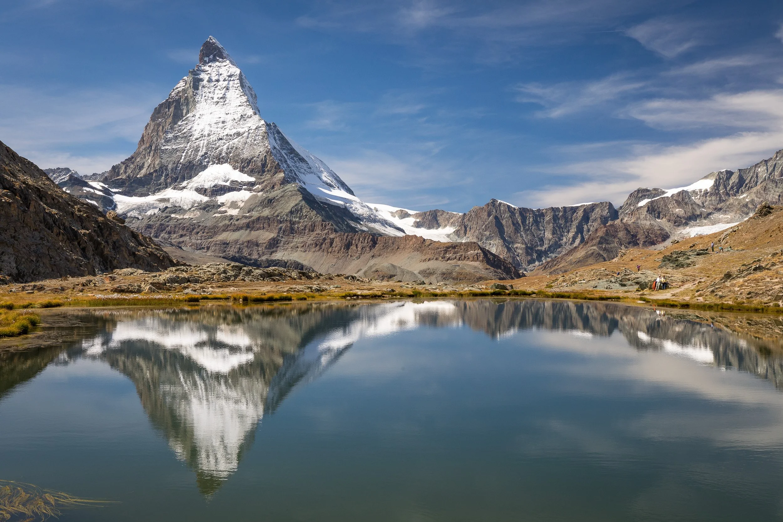
Matterhorn mirrored in the still waters of Riffelsee under a clear late-summer sky above Zermatt in the Swiss Alps.

Woman standing beside Riffelsee, watching the mirror-like reflection of the Matterhorn and the surrounding alpine peaks.
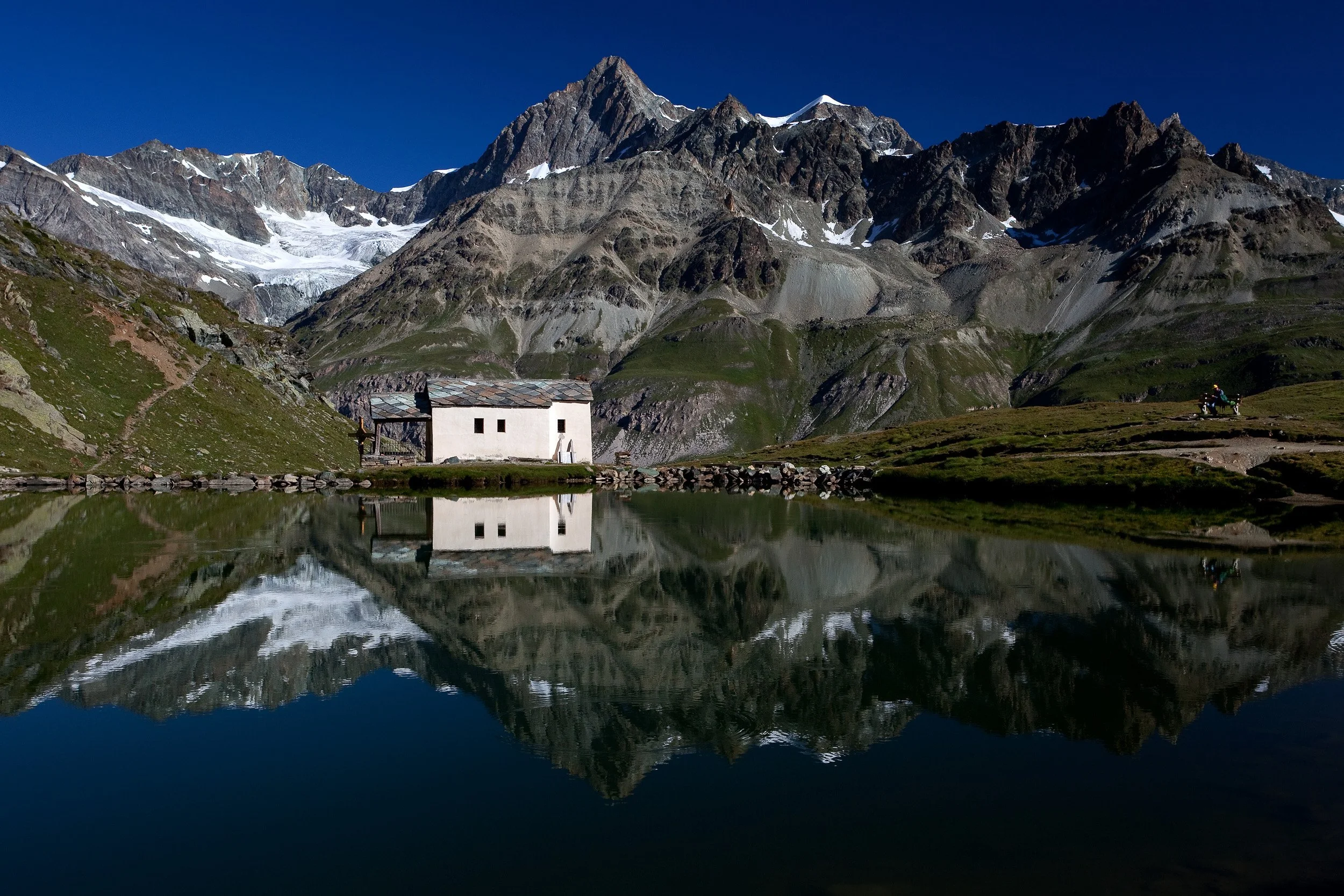
Lonely alpine hut reflected in the still waters of Schwarzsee beneath snow-capped peaks near the Matterhorn above Zermatt.

Matterhorn rising above rolling green ridges and a small mountain lake under a flawless high-summer sky in the Swiss Alps.
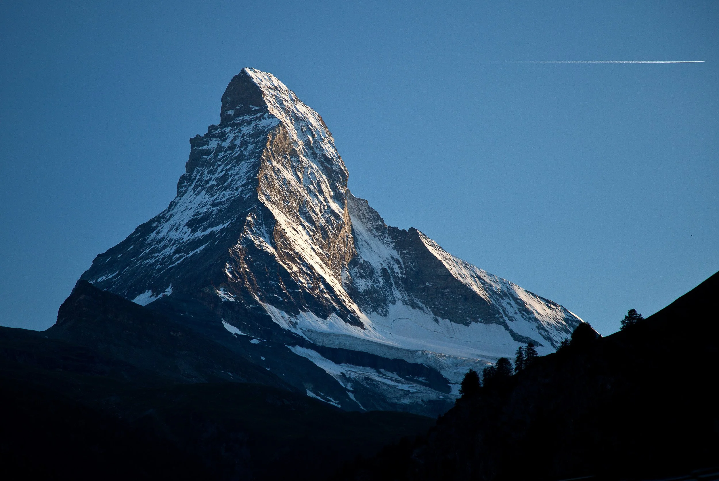
Sharp, snow-dusted profile of the Matterhorn lit by low evening sun, with a single jet trail crossing the clear alpine sky.
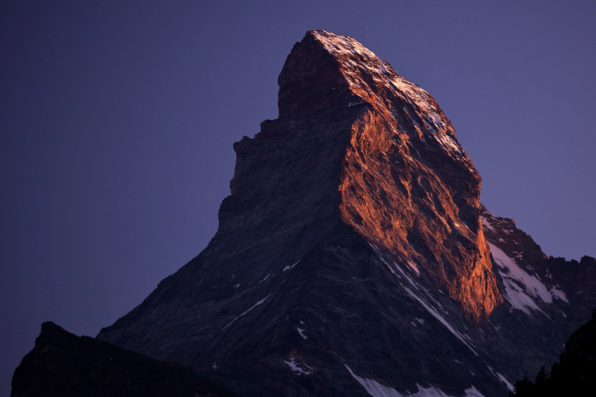
Warm evening light glowing on the steep face of the Matterhorn against a deep blue sky above the village of Zermatt.

Silhouette of the Matterhorn and its reflection in still Riffelsee at dusk, with the last glow of light along the horizon.
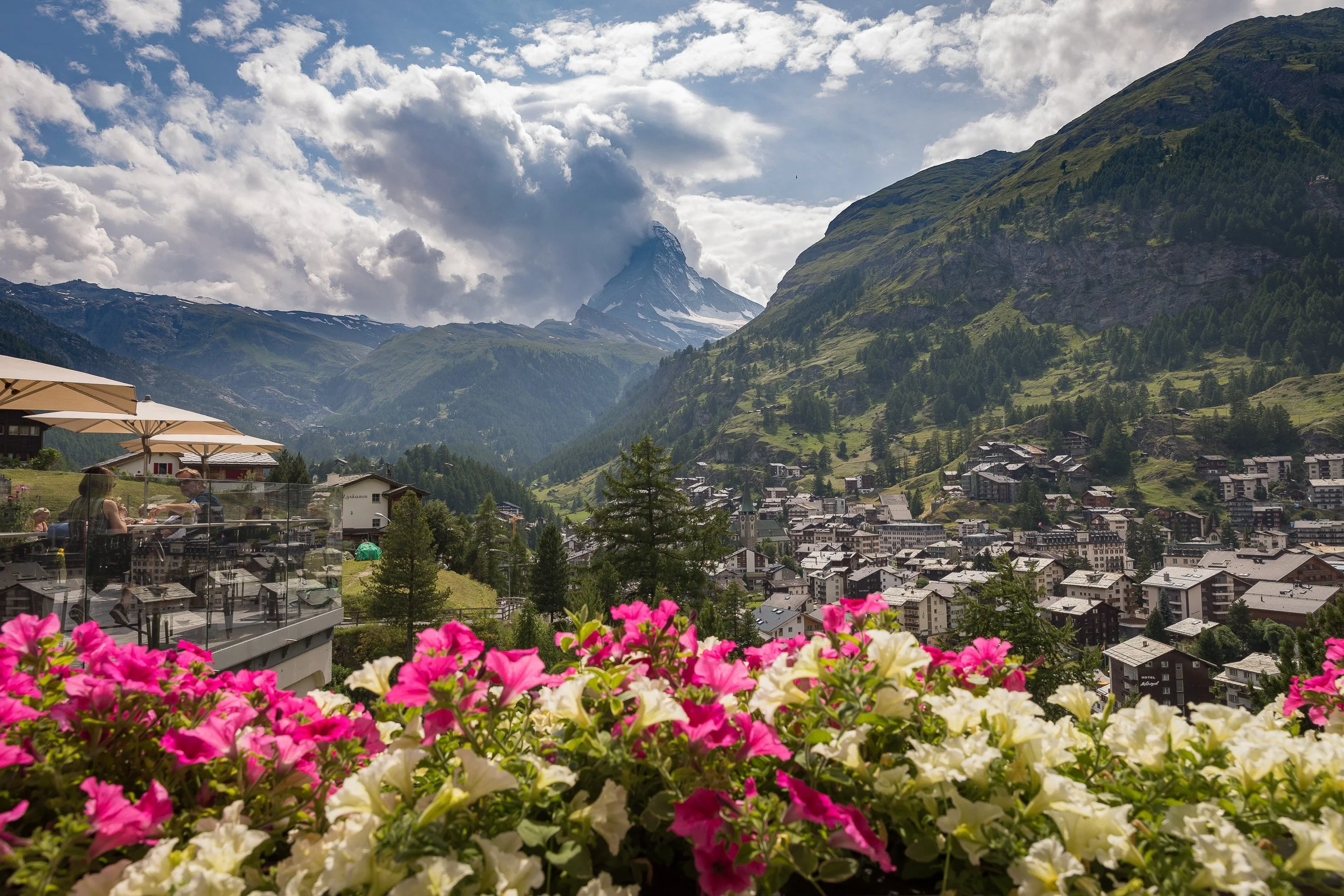
View over a flower-decked terrace in Zermatt, pink and white blooms framing the Matterhorn rising at the head of the valley.
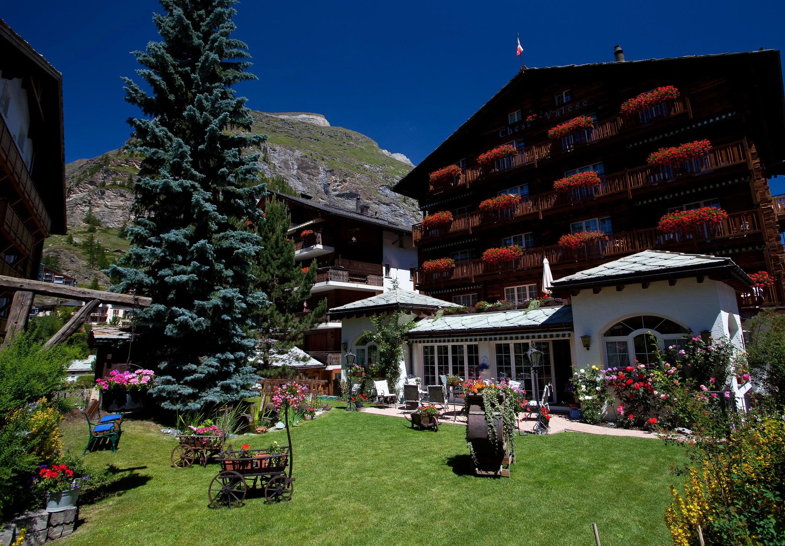
Flower-filled garden in front of a traditional wooden chalet hotel in Zermatt on a bright summer day in the Alps.
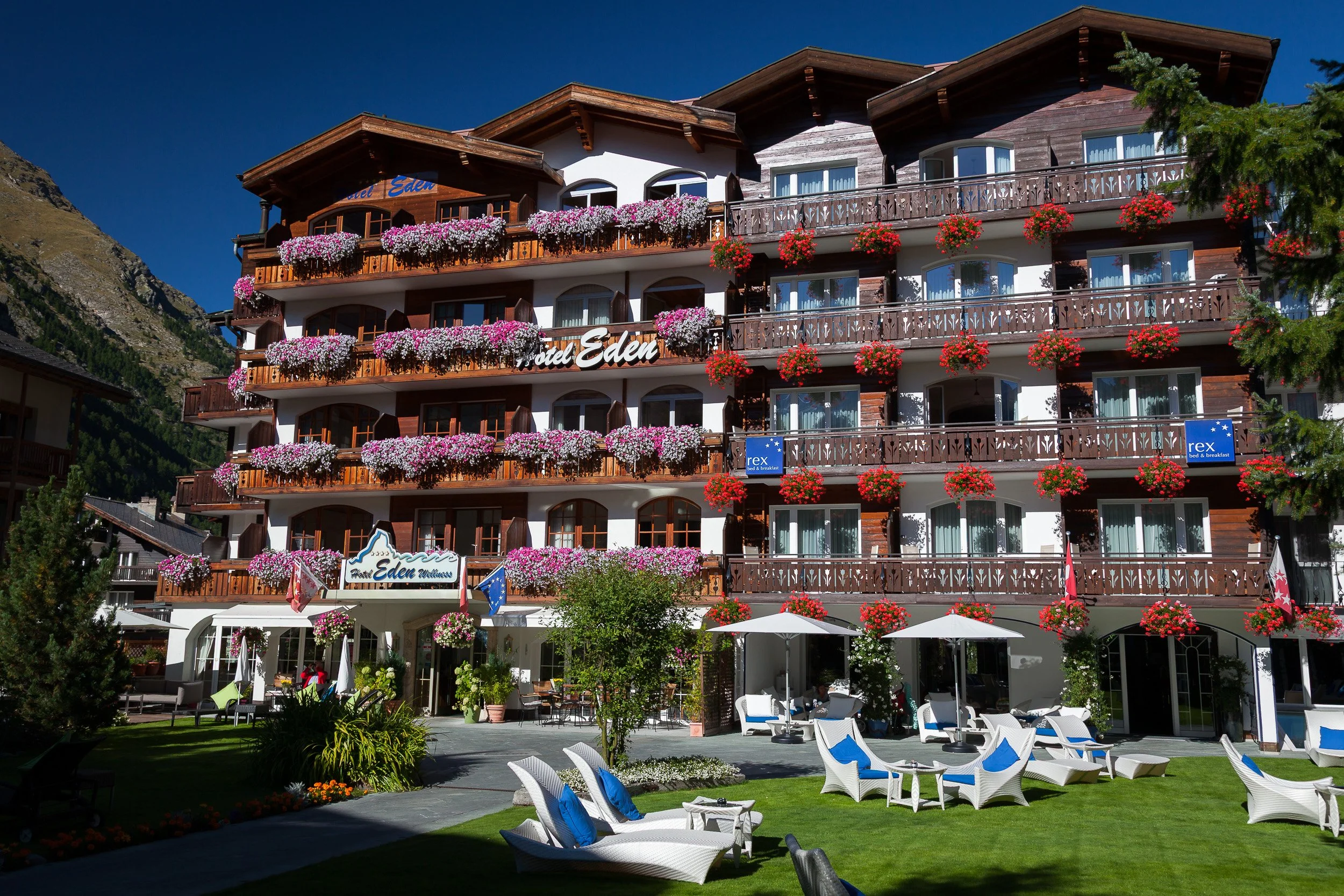
Hotel Eden’s sunlit garden in Zermatt with manicured lawn, loungers and balconies draped in cascades of pink and white flowers.
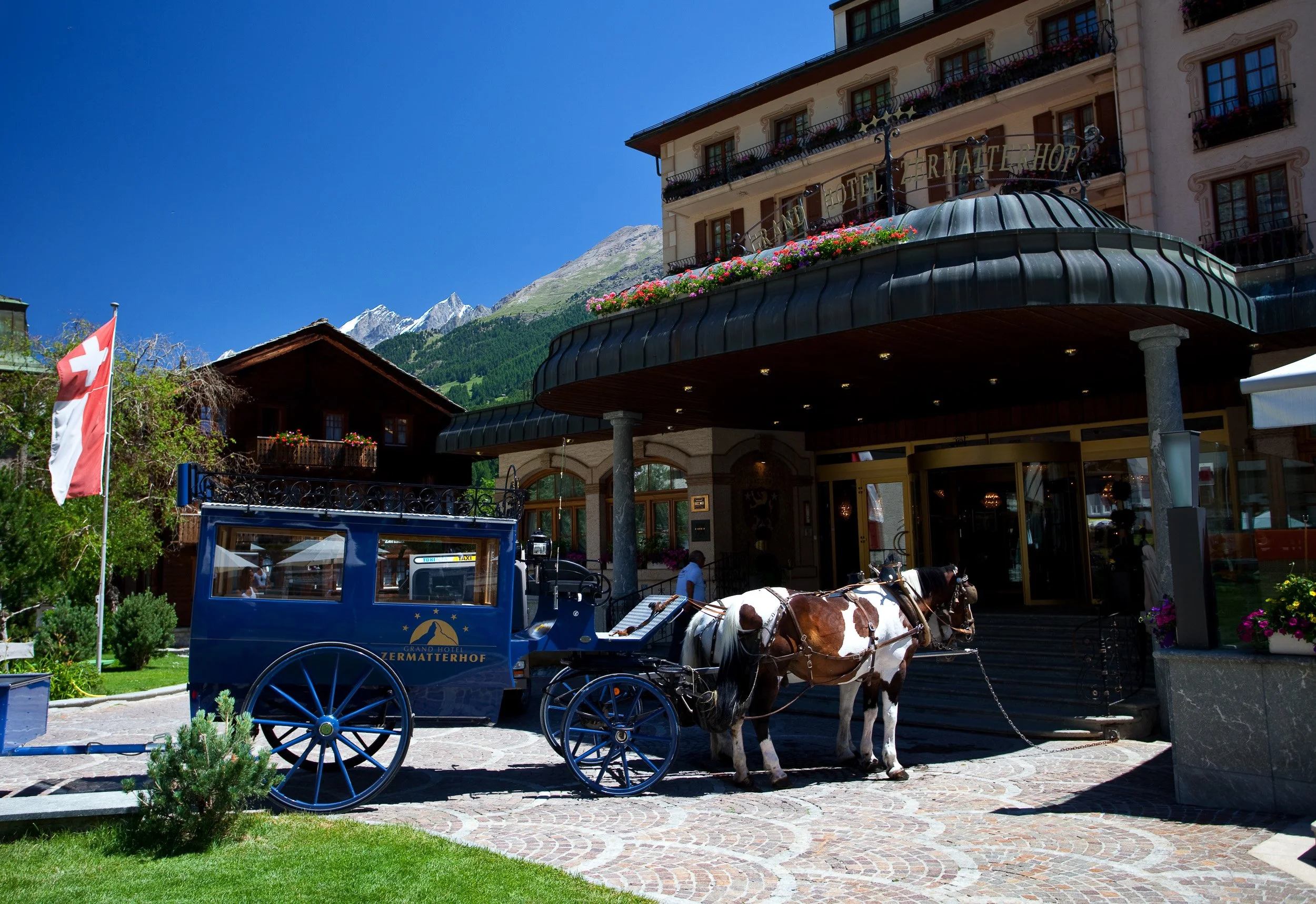
Horse-drawn carriage waiting outside the historic Grand Hotel Zermatterhof in the car-free centre of Zermatt.
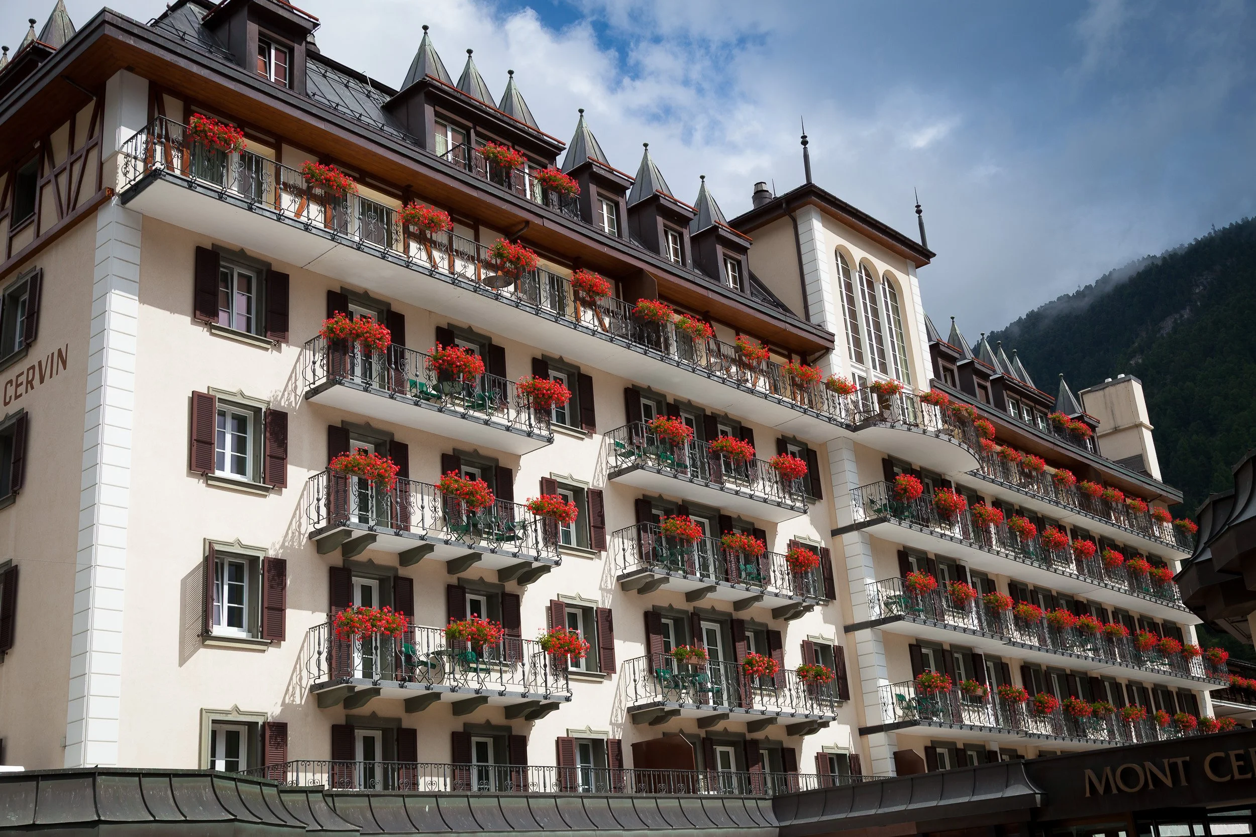
Elegant façade of the historic Mont Cervin hotel in Zermatt, every balcony lined with vivid red flower boxes.
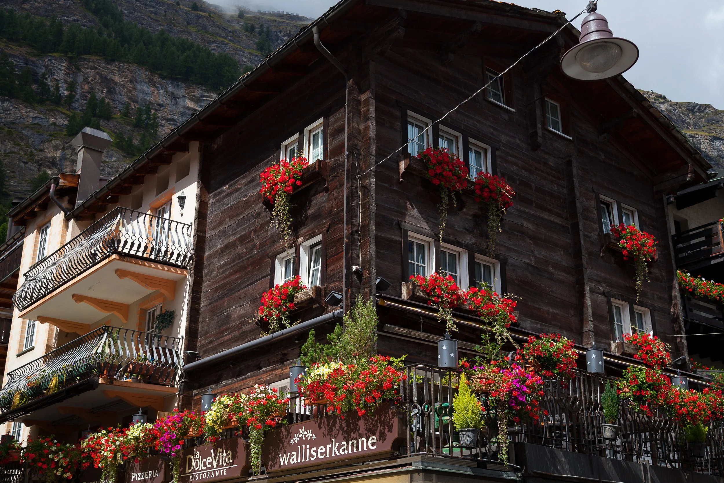
Busy corner restaurant in Zermatt with a dark wooden façade and balconies overflowing with colourful summer flowers above the street.
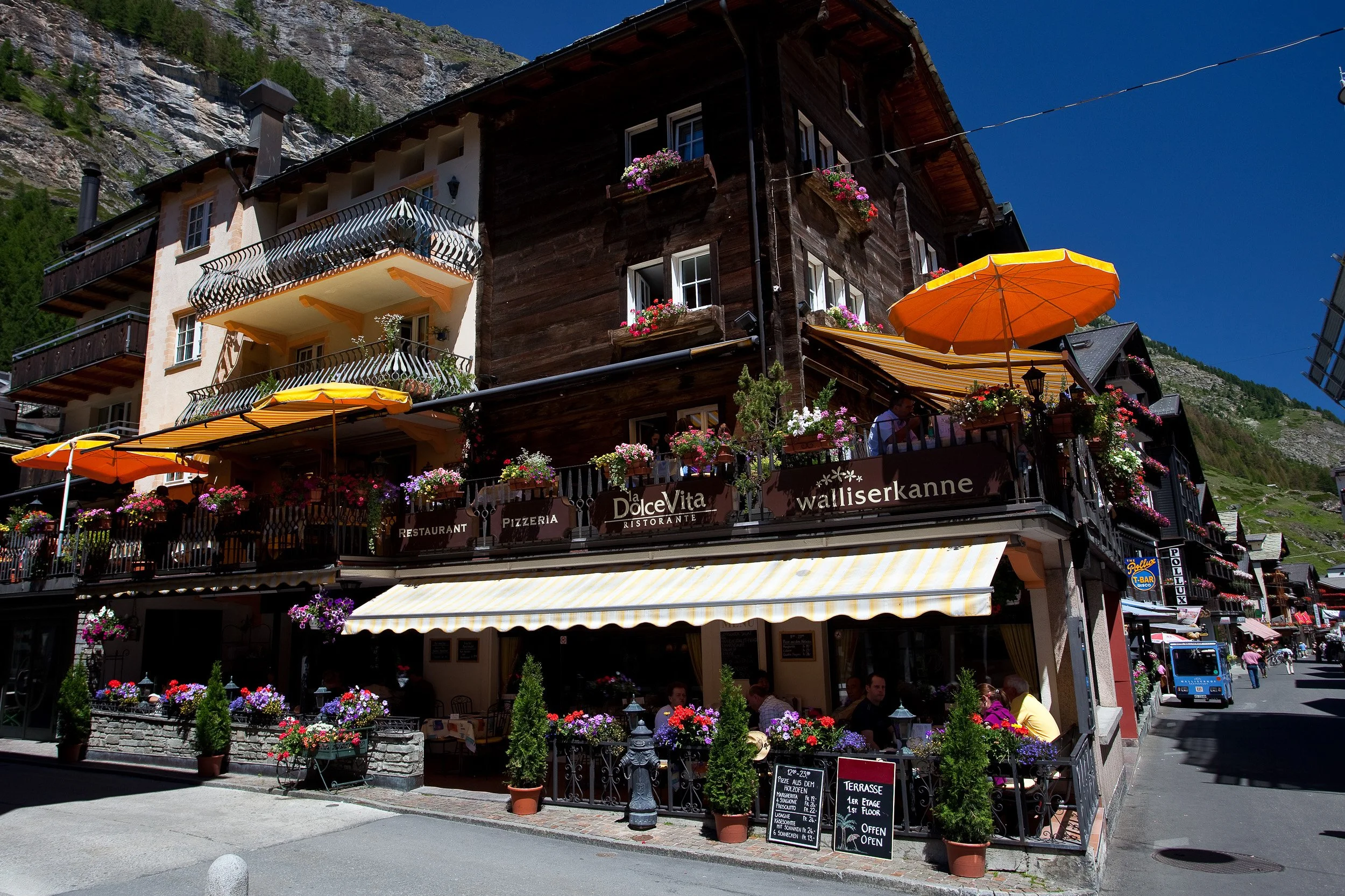
Restaurant balconies in Zermatt overflowing with colourful flowers and yellow parasols along a lively alpine village street.
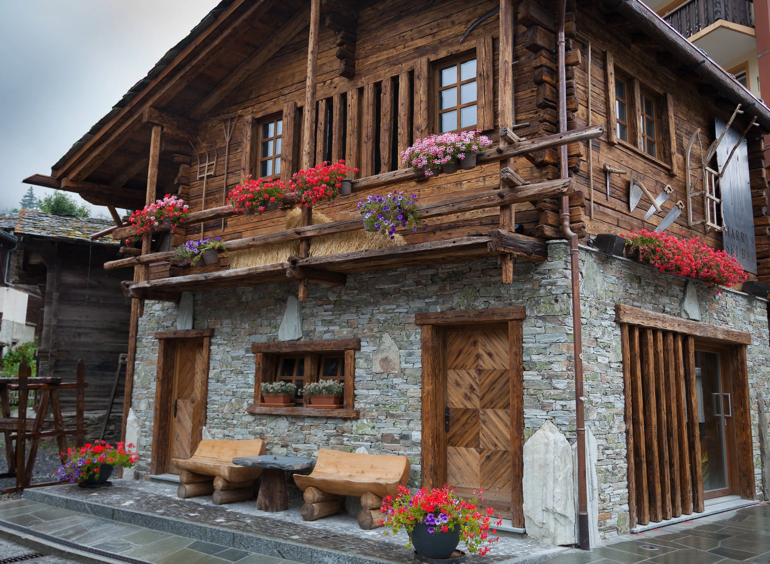
Traditional stone-and-timber chalet in Zermatt with wooden benches and bright red geraniums tucked under the balcony.

Close-up of a chalet façade decorated with old wooden tools and a cascade of red flowers spilling over a stone wall.

Old wooden house window in Zermatt decorated with hiking boots used as flower pots, a vintage rucksack and bright red geraniums.

Cosy wooden façade of Hotel Julen in Zermatt glowing warmly at night, with red shutters and flower-filled balconies.
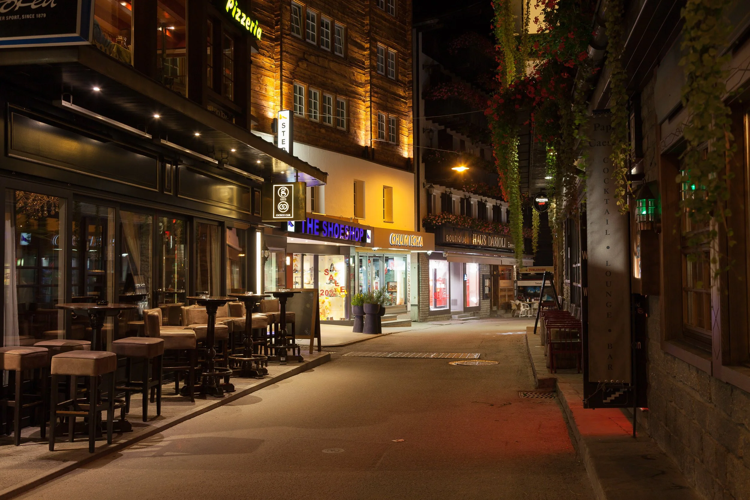
Quiet evening scene in central Zermatt: illuminated shopfronts, bars and empty café tables lining a narrow alpine street.
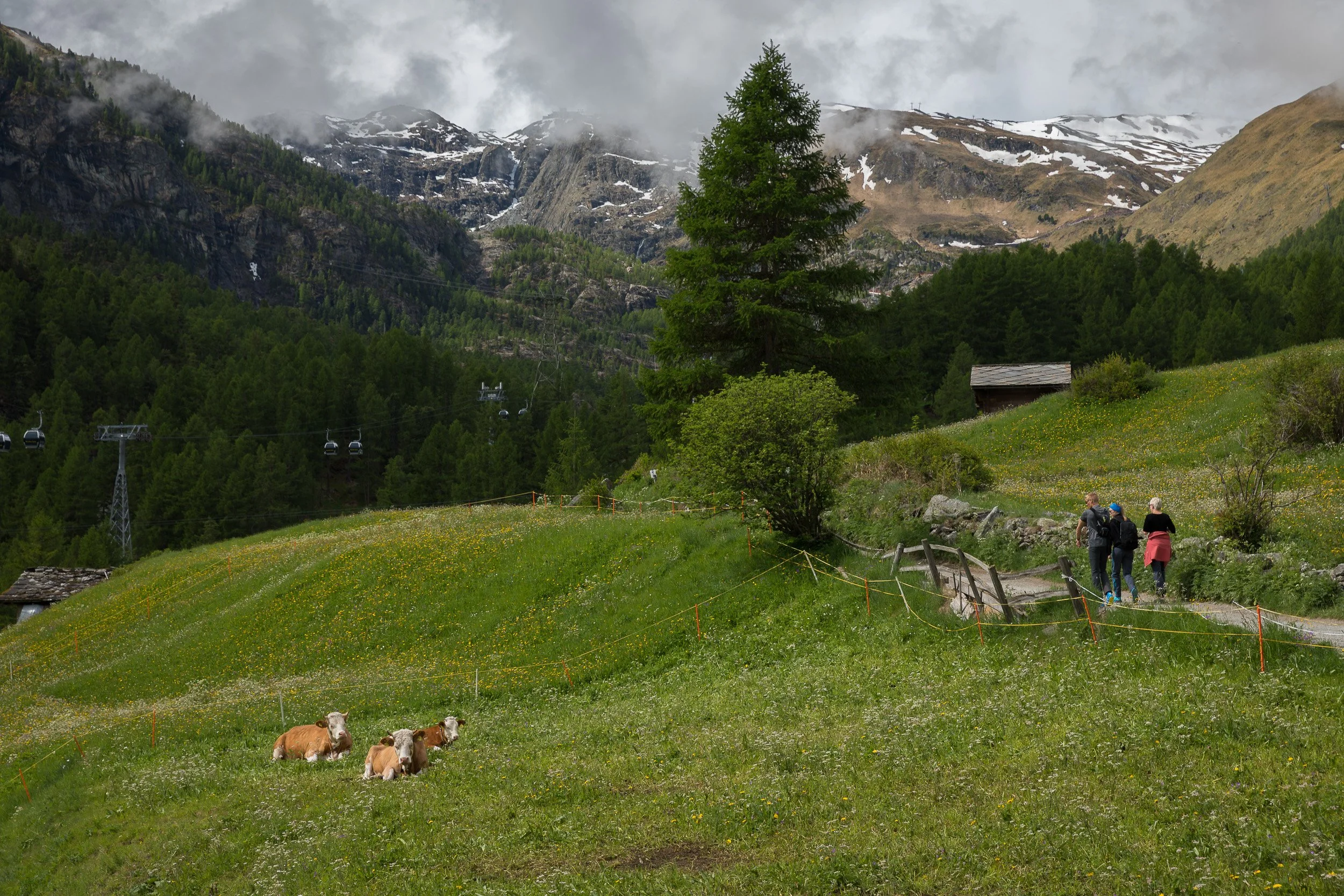
Grazing cows and hikers crossing a flower-rich alpine meadow above Zermatt, backed by dark forests and misty mountain peaks.

Cluster of old wooden barns and chalets on a steep alpine slope above Zermatt, overlooking deep valleys and distant mountains.

Wooden crucifix of Christ near Schwarzsee above Zermatt, framed by glaciers and rugged Swiss peaks under a clear blue sky.
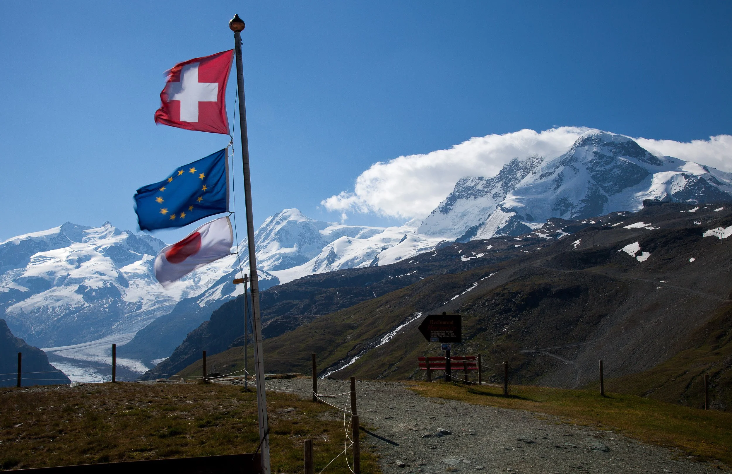
Swiss, European and Valais flags fluttering in front of snow-covered peaks and a long glacier above Zermatt.
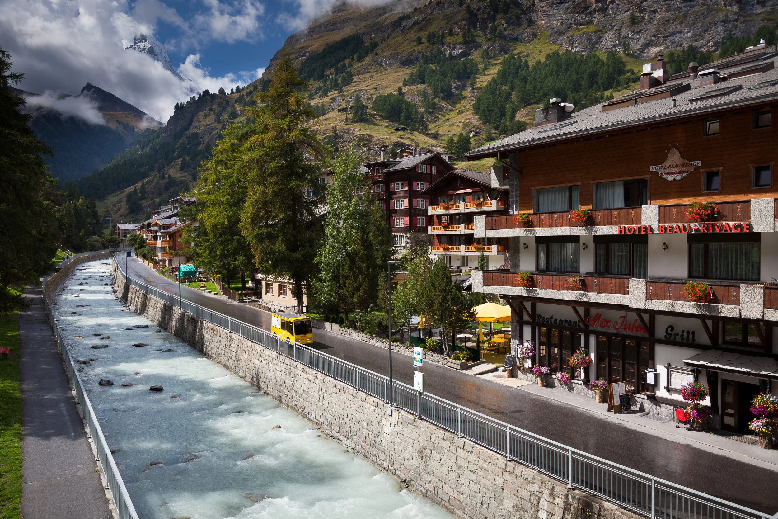
Milky green glacial river running through Zermatt, hotels lining the bank and a cloud-wrapped Matterhorn in the distance.

Long metal suspension bridge spanning a rocky gorge, with hikers crossing high above the forested valley floor.
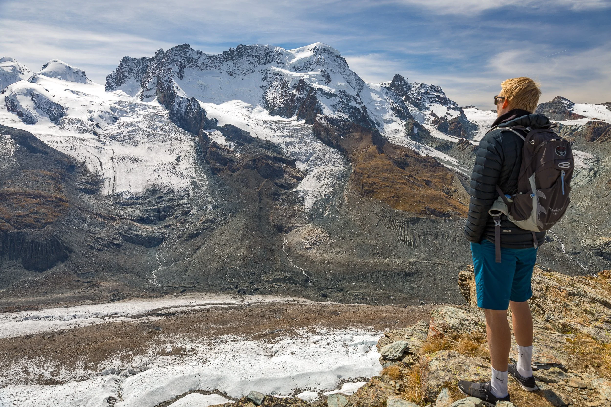
Hiker in a blue jacket standing on a snowy ridge near Gornergrat, gazing towards the Matterhorn and surrounding 4,000-metre peaks.
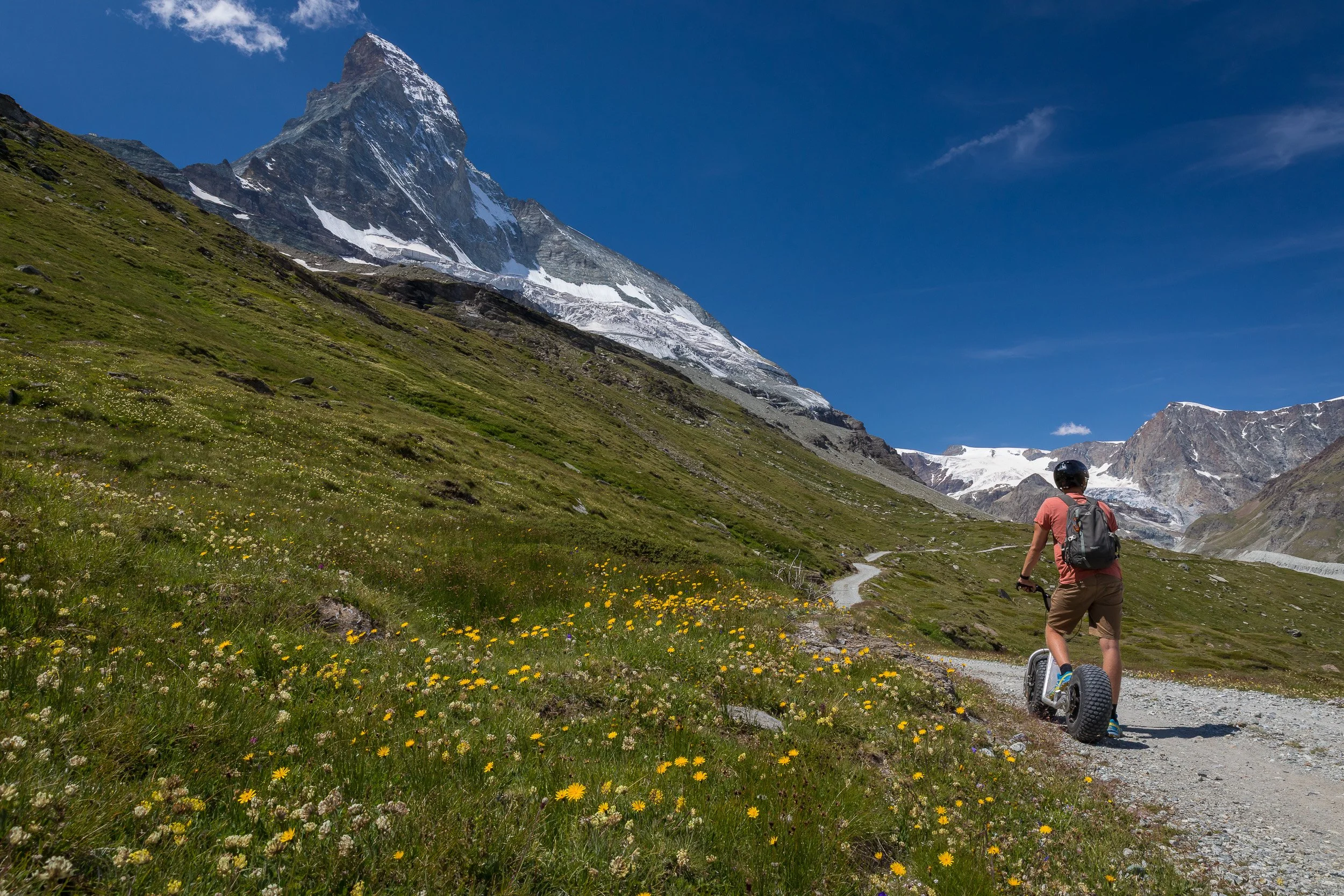
Young rider on an off-road scooter following a winding alpine trail towards the Matterhorn through a meadow of yellow wildflowers.
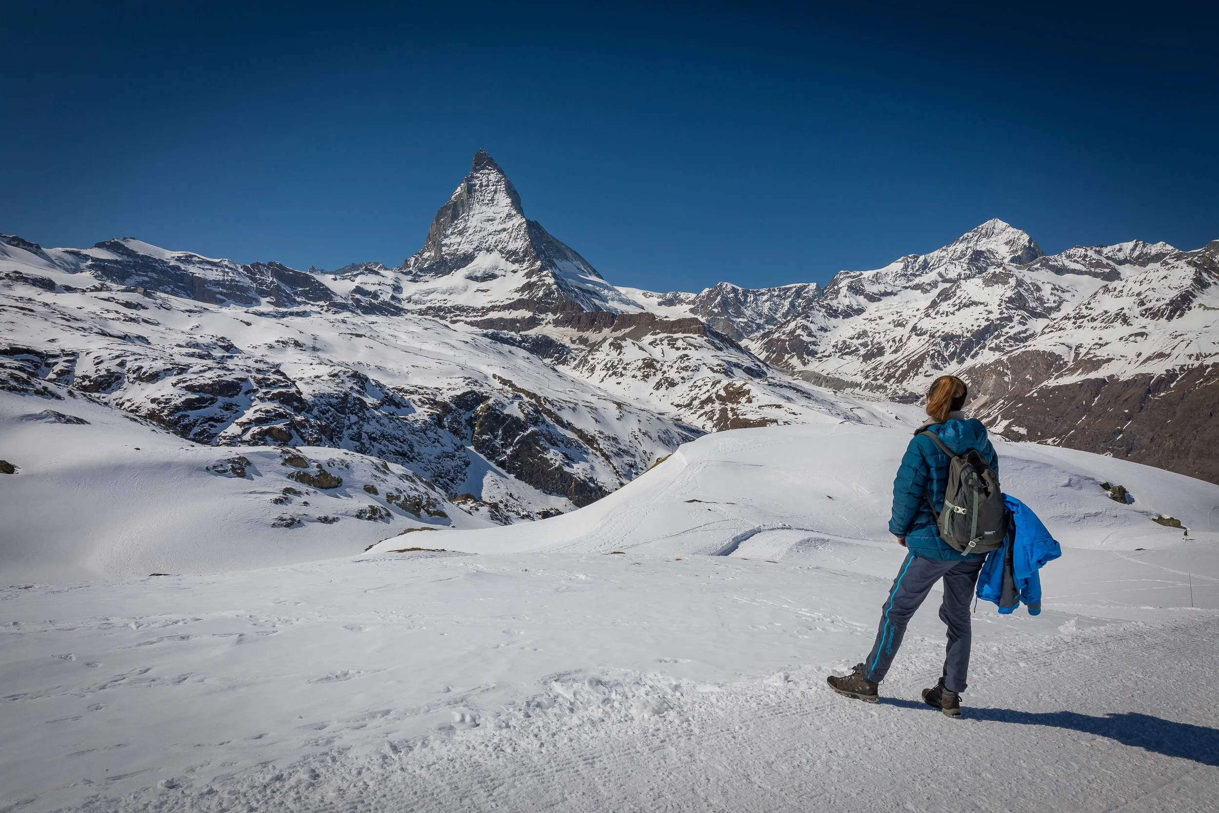
Blue-jacketed hiker pausing on a snowy Gornergrat ridge, looking out over the Matterhorn and a sea of jagged alpine peaks.
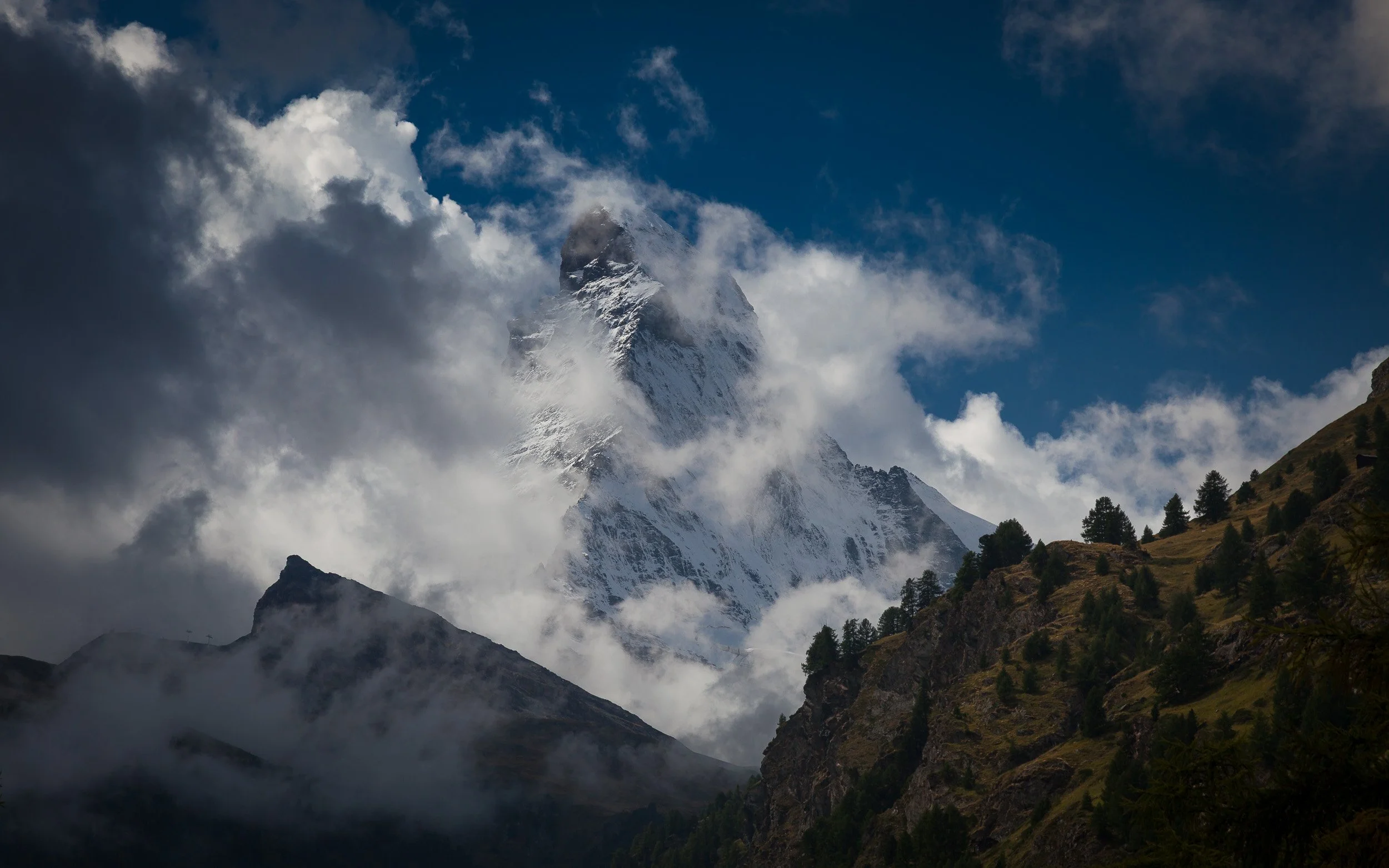
Dark storm clouds swirling around the peak of the Matterhorn above shadowed forests on the lower slopes.
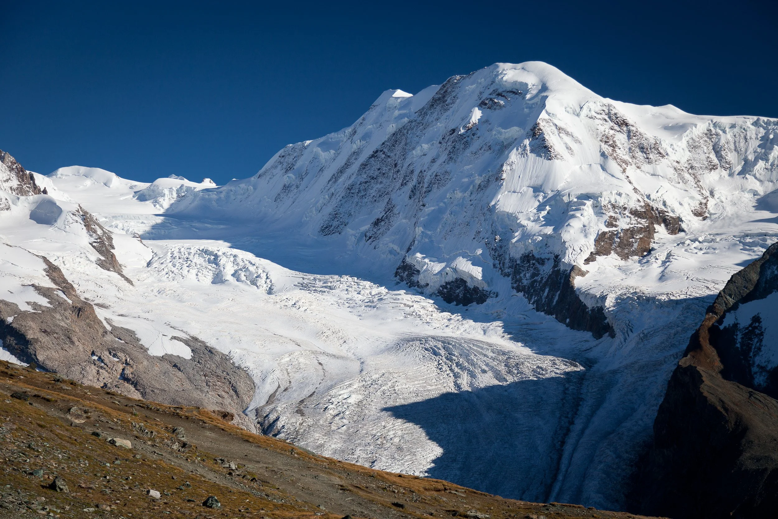
Vast white glacier and high alpine peaks near Gornergrat, streaked with crevasses and framed by a deep blue Swiss sky.

Orange Gornergrat cogwheel train standing at a mountainside station above Zermatt under a clear blue sky.
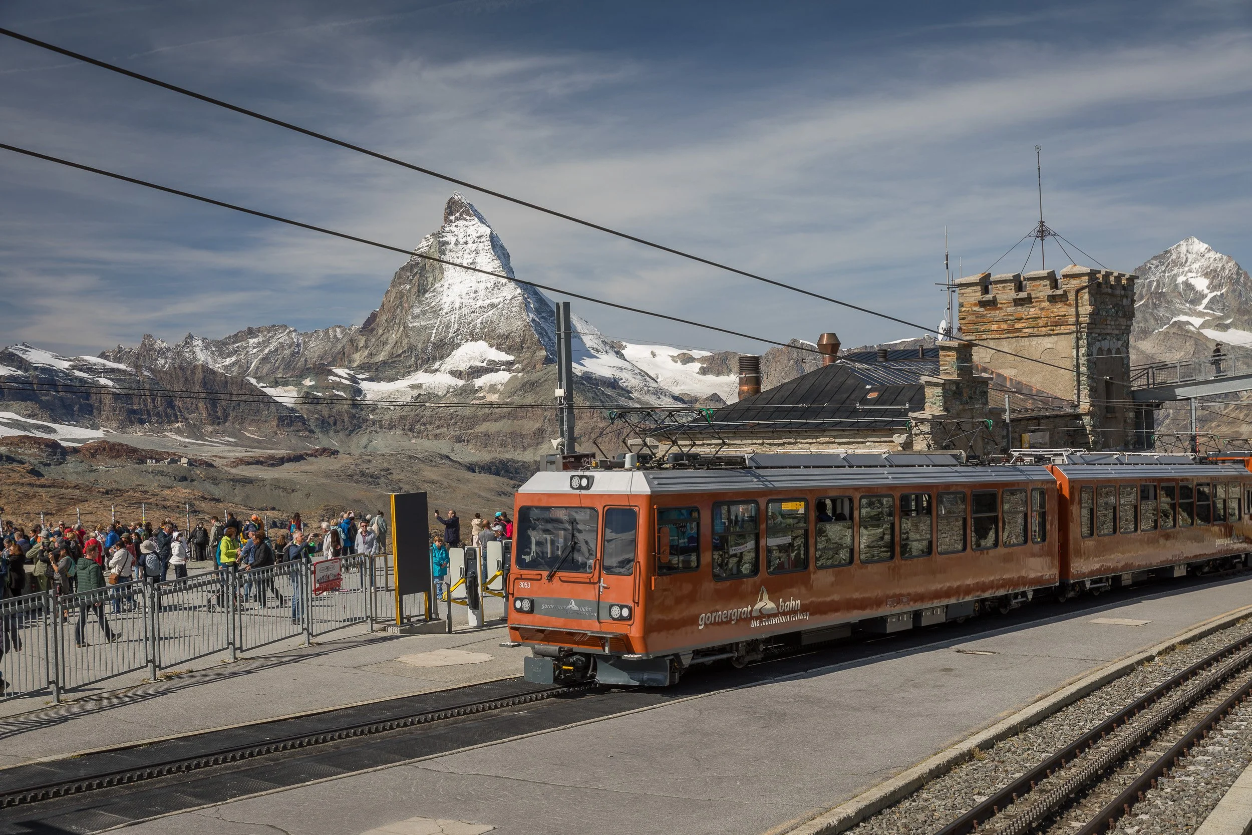
Crowds at the Gornergrat summit station as the orange cogwheel train arrives, with the Matterhorn towering in the background.

Modern Gornergrat train curving along high mountain tracks with the Matterhorn and rocky ridges behind.
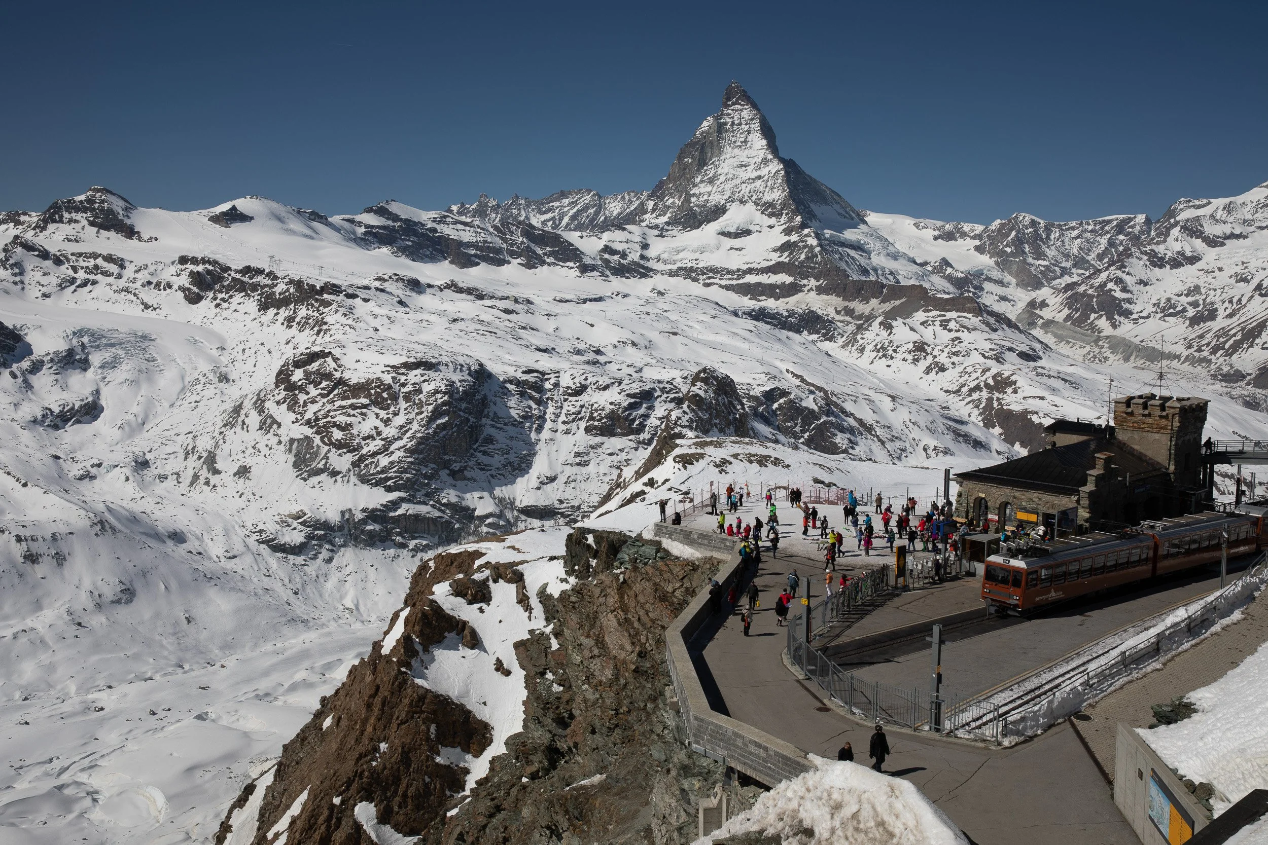
Winter panorama from Gornergrat, with skiers on the viewing terrace, the cogwheel train and the Matterhorn dominating the skyline.
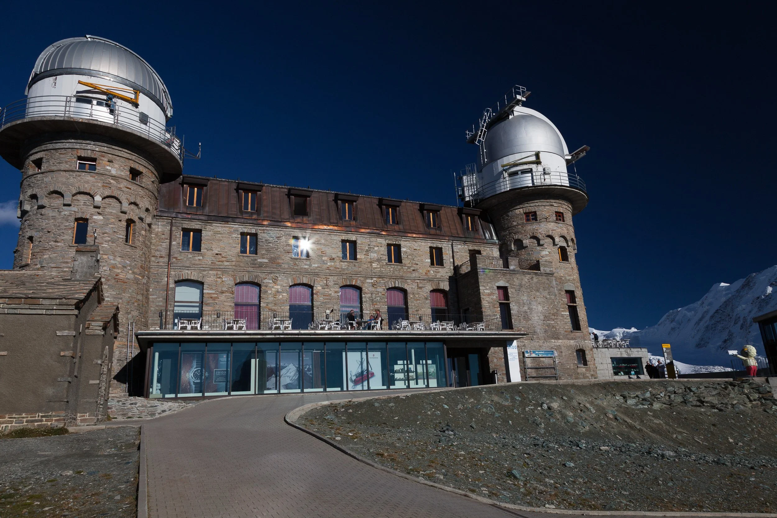
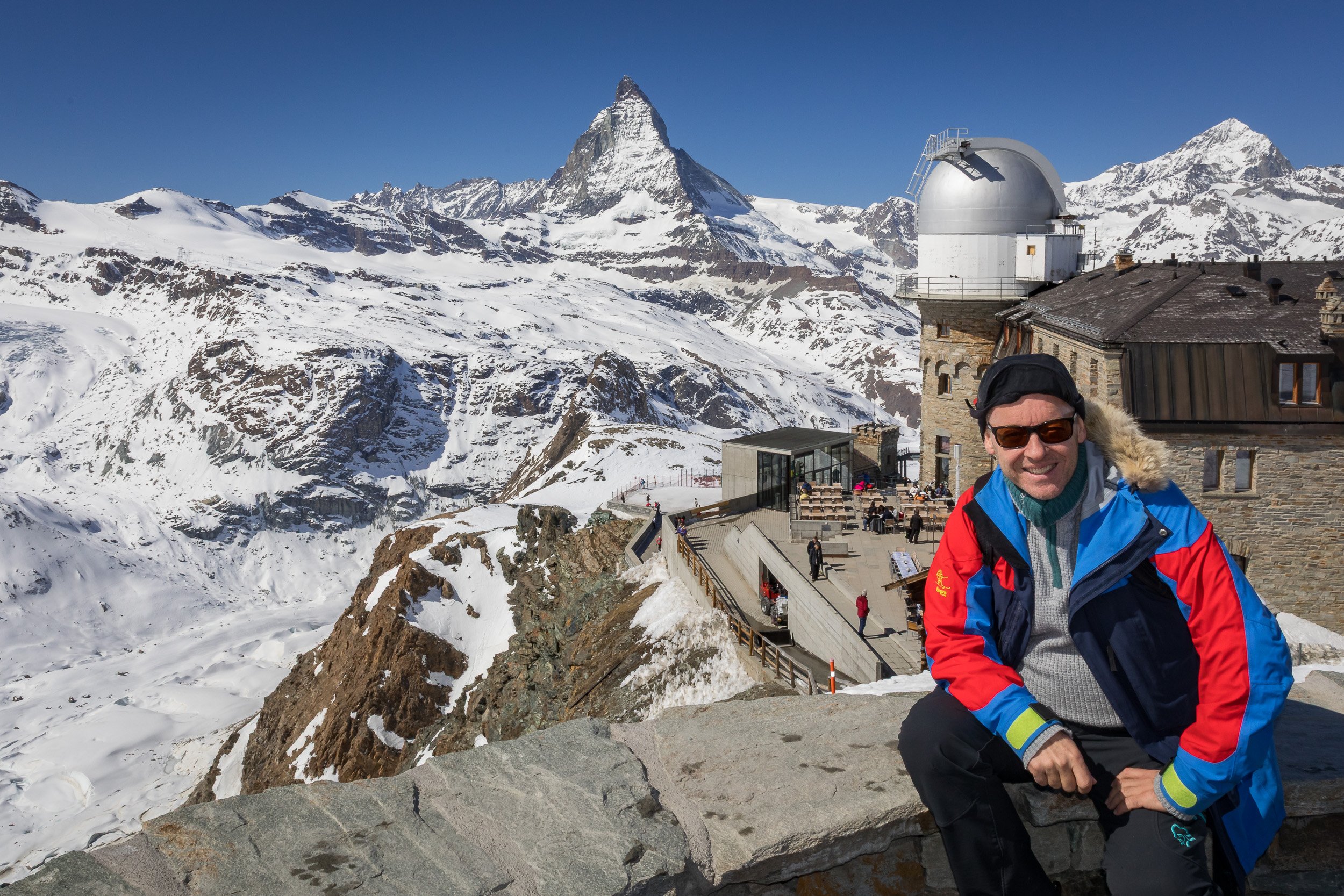
Kulmhotel Gornergrat’s stone buildings and observatory domes perched high above the surrounding Swiss Alps.
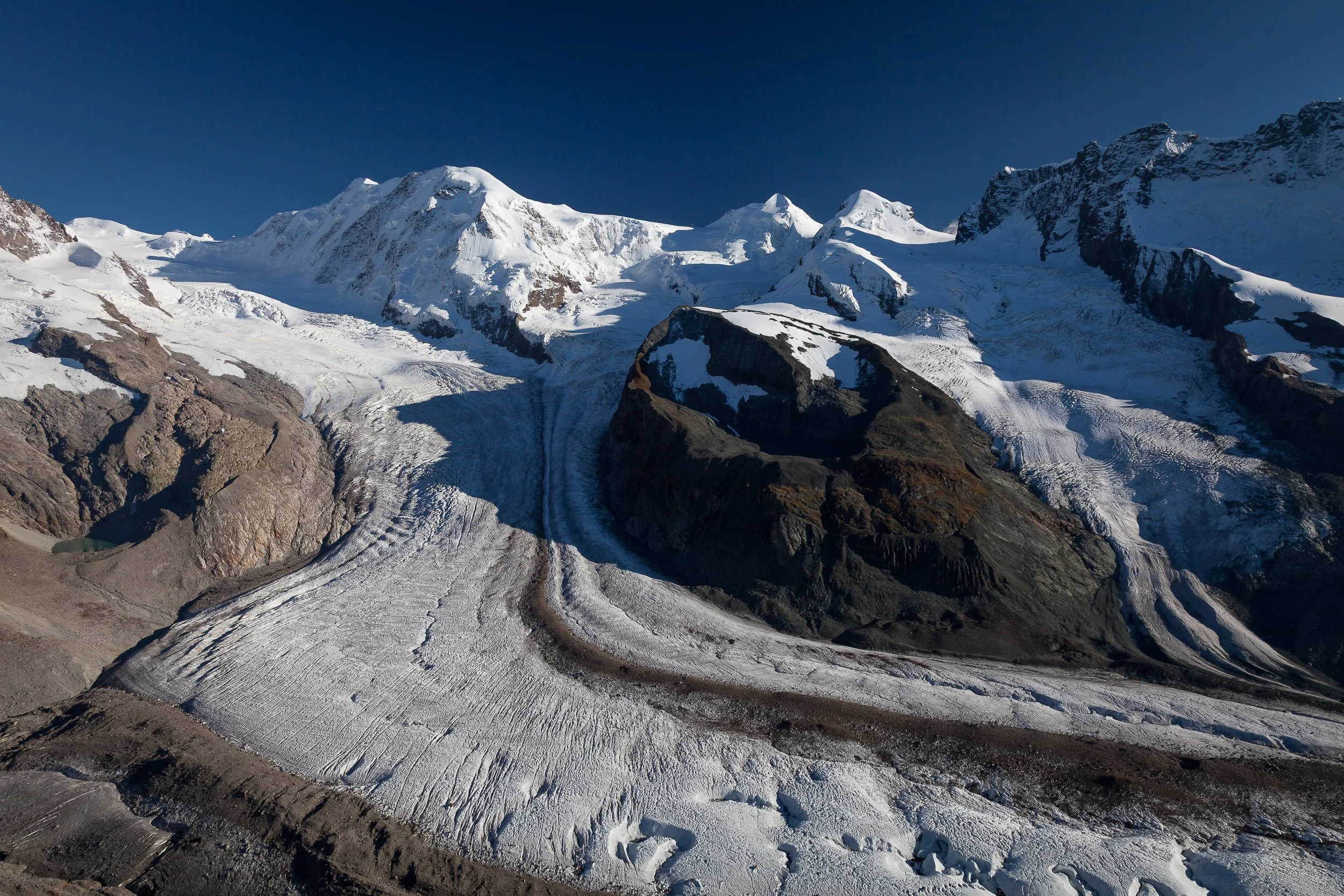
Sweeping view over the Gorner glacier and surrounding 4,000-metre peaks from the Gornergrat viewpoint above Zermatt.
All photographs on this page were taken by Norwegian landscape and travel photographer Svein Magne Tunli.