Travel Photography
Travel photography from selected destinations around the world — from Arctic coastlines, historic cities and desert landscapes to safari scenes, island shores and quiet coastal places.
This collection brings together journeys shaped by light, atmosphere, architecture, landscape and a calm sense of place.
Kanuhura in the Maldives, with palm trees, white sand, beach loungers and a turquoise lagoon stretching towards an overwater pavilion.

Sunrise in Maasai Mara, Kenya, with acacia trees silhouetted against an orange sky and hot-air balloons drifting above the open savanna.

Anse Source d’Argent on La Digue, Seychelles, with smooth granite boulders, white sand, palm trees and shallow turquoise water beneath shifting tropical light.
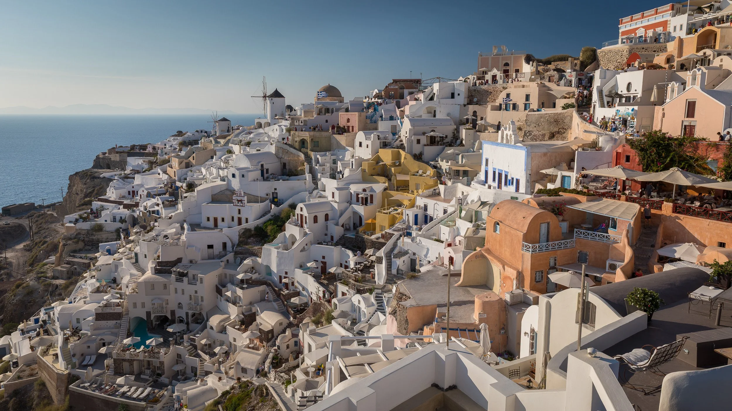
Santorini, Greece, with whitewashed houses, domed churches and windmills layered across volcanic cliffs above the Aegean Sea.

Burj Khalifa in Dubai, United Arab Emirates, rising above illuminated palms, arches and reflecting pools in warm night light.

Sheikh Zayed Grand Mosque in Abu Dhabi, United Arab Emirates, with glowing arches, white domes and courtyard reflections beneath the evening sky.
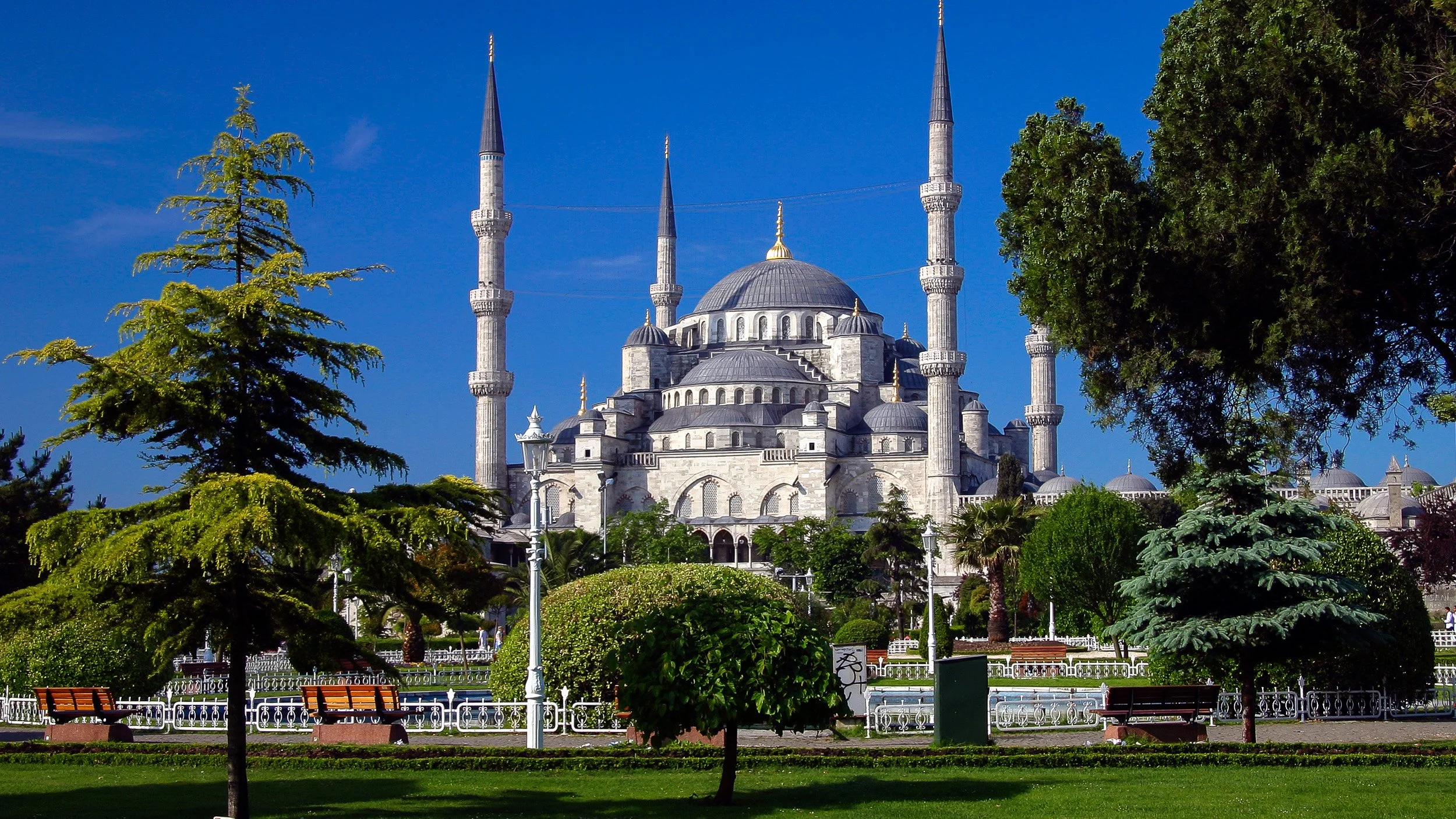
The Blue Mosque in Istanbul, Turkey, with domes, slender minarets and garden trees standing against a clear blue sky.

Brooklyn Bridge in New York City, USA, with illuminated towers, steel cables and the Manhattan skyline reflected across the East River at dusk.

Golden Gate Bridge in San Francisco, USA, spanning the strait beneath a wide sky, with red towers, hills and boats shaping the coastal view.

Tower Bridge in London, UK, illuminated at blue hour above the River Thames, with its stone towers and steel spans filling the frame.

Venice, Italy, with a narrow canal, brick façades, arched windows and warm evening light reflected in still water.

Manarola in Cinque Terre, Italy, with colourful cliffside houses, terraced slopes and turquoise waves breaking below the village.

Piran, Slovenia, with terracotta rooftops, a tall church tower and the Adriatic Sea surrounding the compact coastal town.

Dubrovnik old town in Croatia – fortified stone walls and terracotta roofs overlook the blue Adriatic Sea. From above, you see the tight maze of streets and the contrast between the old city and open water.

Colmar in Alsace, France, with colourful half-timbered houses, flower boxes and reflections along a narrow canal in the historic old town.

Prague, Czech Republic, with the Old Town Square, the Astronomical Clock tower and the Church of Our Lady before Týn under a clear summer sky.

Bratislava, Slovakia, with the old town, red rooftops, church spires and the hilltop castle rising above the historic centre.

Krakow, Poland, with the Main Market Square, the Cloth Hall, evening lights and horse carriages beneath a deep blue sky.

Berlin, Germany – Brandenburg Gate on Pariser Platz illuminated after dark, with people gathered beneath its classical columns in the heart of the city.

Kempinski Hotel Cathedral Square in Vilnius, Lithuania, with illuminated façades, cobbled streets and light trails through the old city at night.

Saint Basil’s Cathedral in Moscow, Russia, with colourful onion domes and illuminated brickwork standing against a deep evening sky.

Church of the Saviour on Spilled Blood in St. Petersburg, Russia, with ornate façades and colourful domes glowing in blue-hour light.

Tuscany, Italy, with rolling hills, cypress-lined roads and a farmhouse set among dry summer fields and soft evening light.

Douro Valley, Portugal, with terraced vineyards, olive trees and evening light over the winding river below.
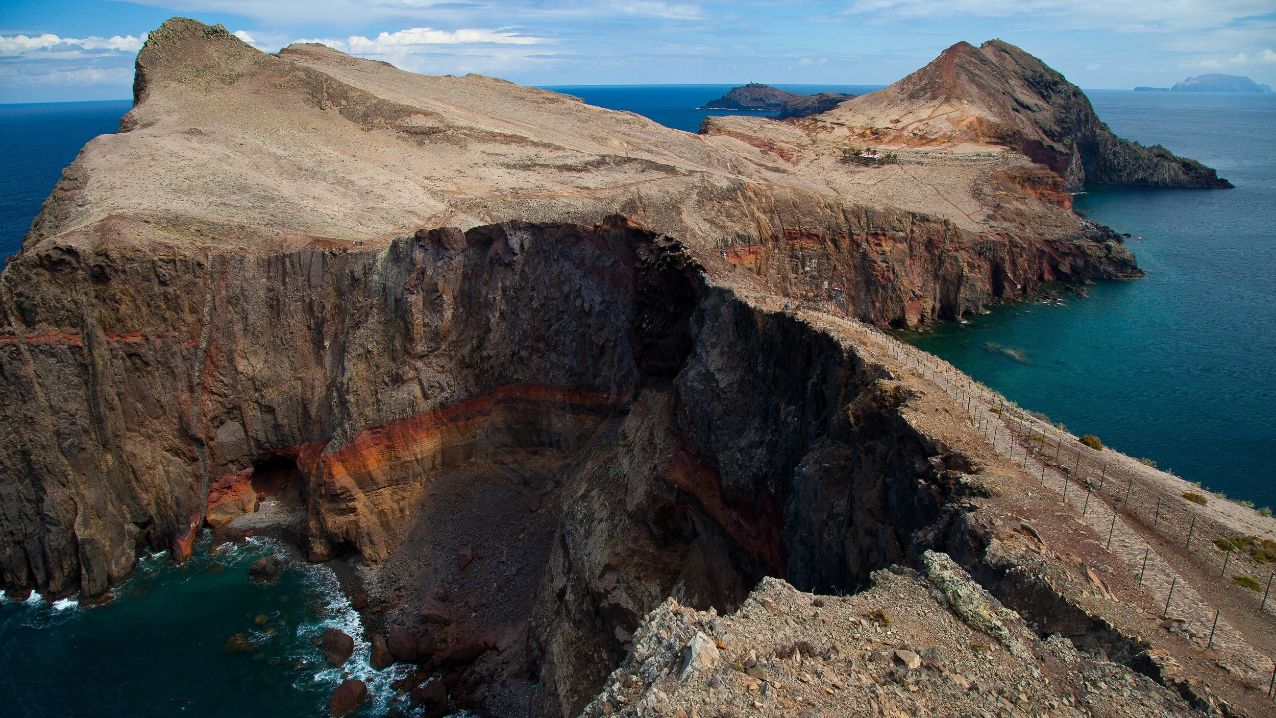
Ponta de São Lourenço on Madeira, Portugal, with red-brown volcanic cliffs, narrow ridges and deep Atlantic water around the rugged headland.

Aiguille du Midi in Chamonix, France, with snow-covered ridges, glaciers and mountain walkways high above the Mont Blanc massif.

Seljalandsfoss waterfall in South Iceland, with white water falling from a green cliff into mist and bright summer grass below.

Zodiac landing in Magdalenefjorden, Svalbard, with expedition guides on the rocky shore, clear Arctic water, drifting ice and snow-dusted peaks beyond.

Antelope Canyon in Arizona, USA, with flowing red sandstone walls, narrow passages and soft reflected light inside the slot canyon.

Horseshoe Bend on the Colorado River, USA, with a person sitting near the canyon rim above layered red rock and deep green water far below.

Bryce Canyon National Park in Utah, USA, with orange hoodoo formations, deep gullies and warm sunlight across the amphitheatre of rock.

Half Dome in Yosemite National Park, California, USA – a huge granite monolith rises above the valley in warm evening light. Forests, cliffs and the clear sky around it highlight the scale of this famous American landmark.

Napili Kai Beach on Maui, Hawaii, USA, with a sheltered crescent bay, palm trees, low shoreline buildings and calm Pacific water.

Waialae Beach Park on Oahu, Hawaii, USA, with palm trees, an outrigger canoe, soft sand and calm turquoise Pacific water.

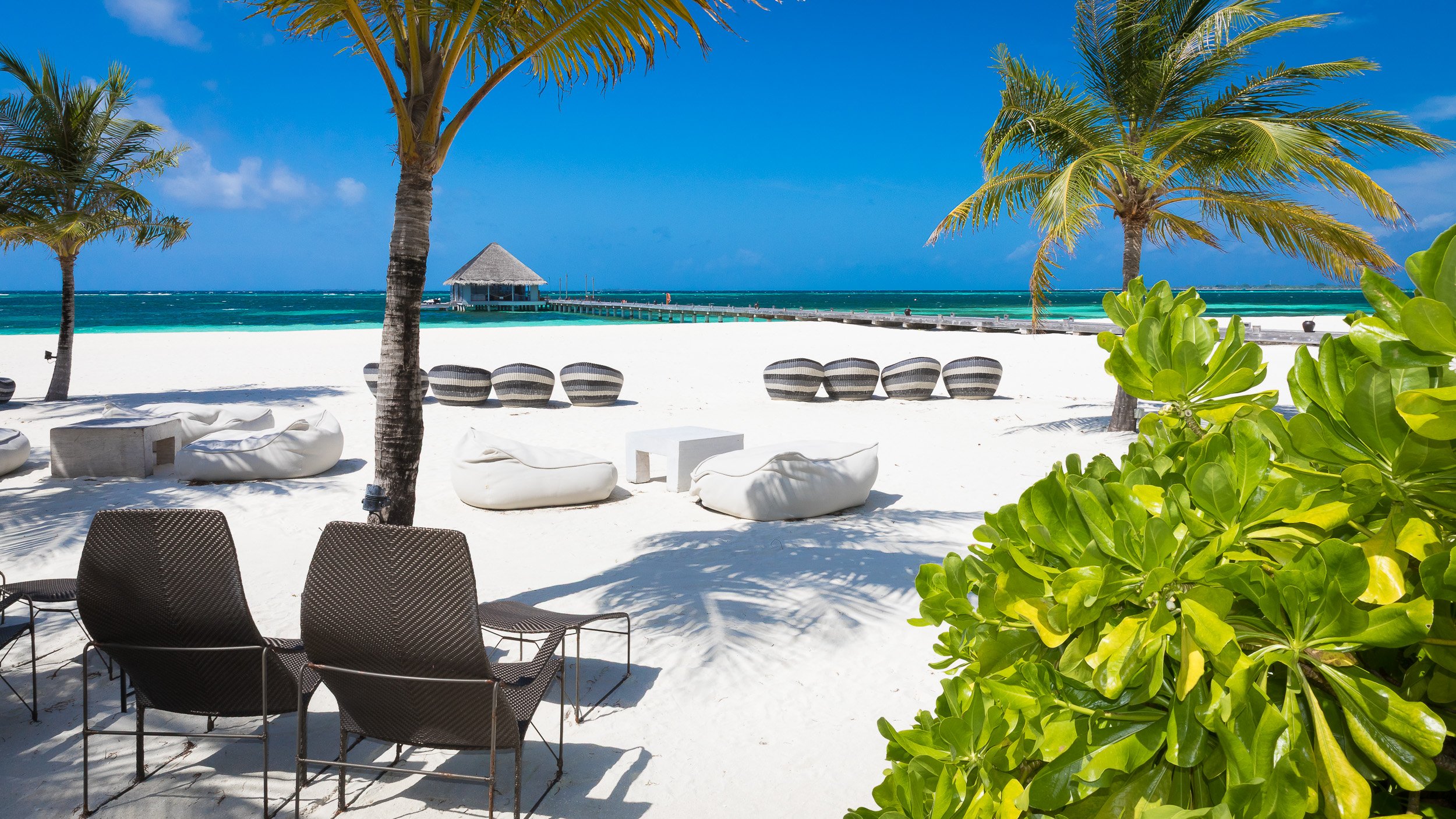
Kanuhura island in the Maldives, with overwater bungalows, white sand and palm trees set within a calm turquoise atoll.

Constance Lemuria Resort on Praslin, Seychelles, with a woman resting in an infinity pool above palms, granite boulders and a turquoise beach.

Anse Source d’Argent on La Digue, Seychelles, with sculpted granite rocks, leaning palms, shallow turquoise water and soft surf under dramatic clouds.

Belle Mare Beach in Mauritius, with a woman wading through shallow turquoise water beneath dark clouds and soft coastal light.
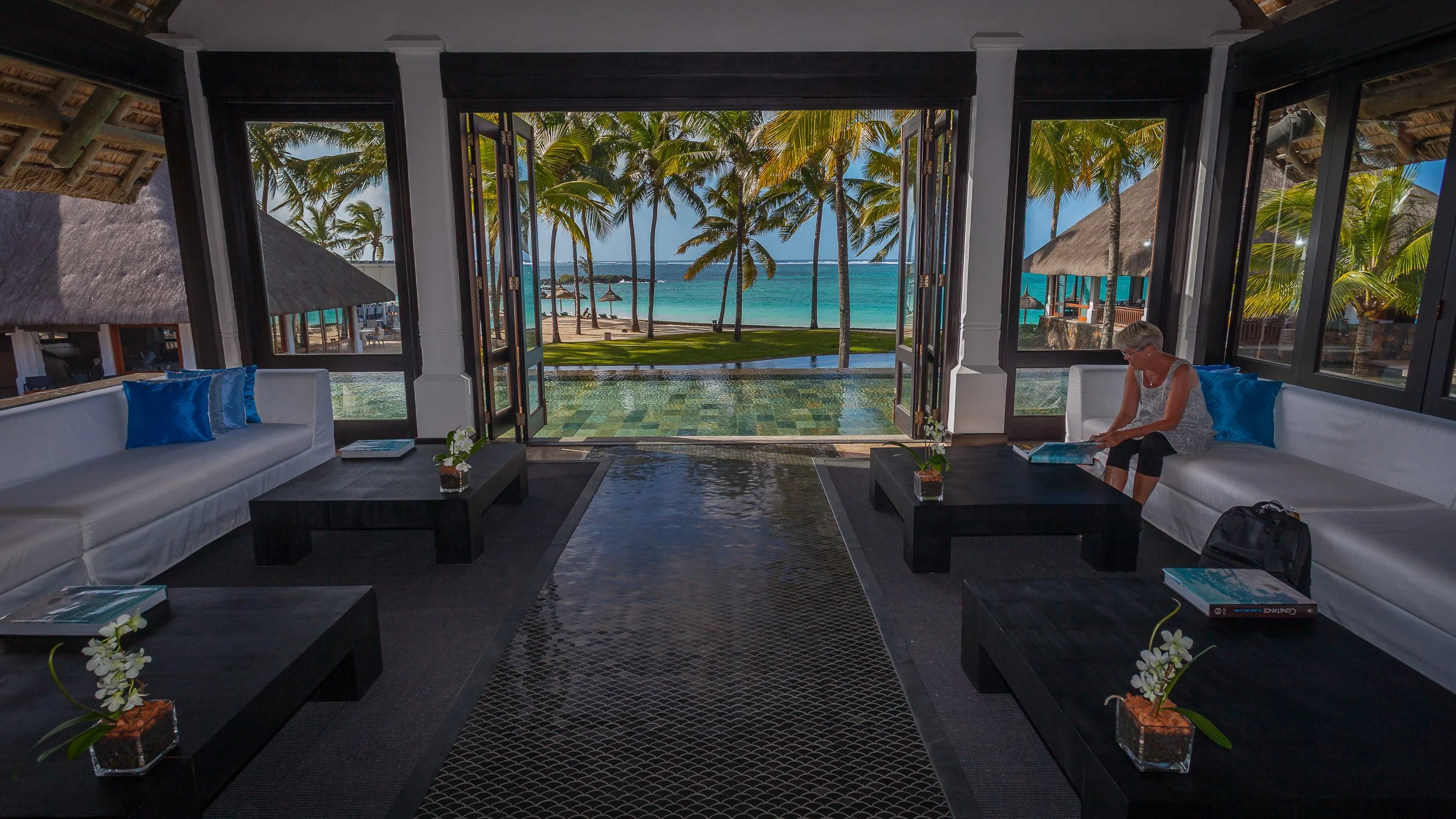
Constance Belle Mare Plage in Mauritius, with open lounge seating, dark wood interiors, palms and turquoise lagoon views beyond the terrace.
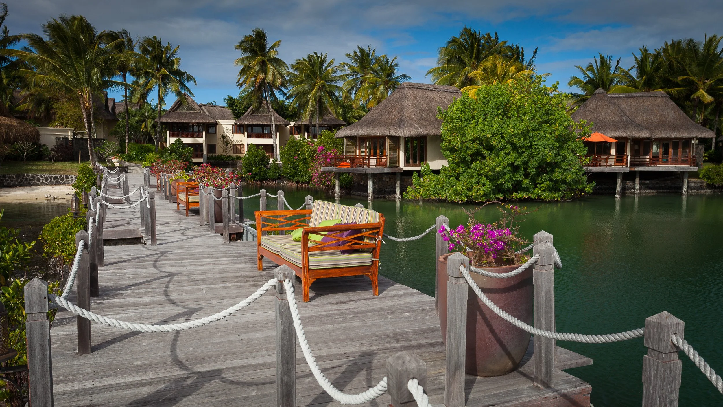
Constance Le Prince Maurice in Mauritius, with thatched villas, wooden walkways, palms and calm green lagoon water in a tropical garden setting.

Farsha Mountain Lounge in Sharm El Sheikh, Egypt, with colourful terraces, low tables and rustic wooden structures above the turquoise Red Sea.
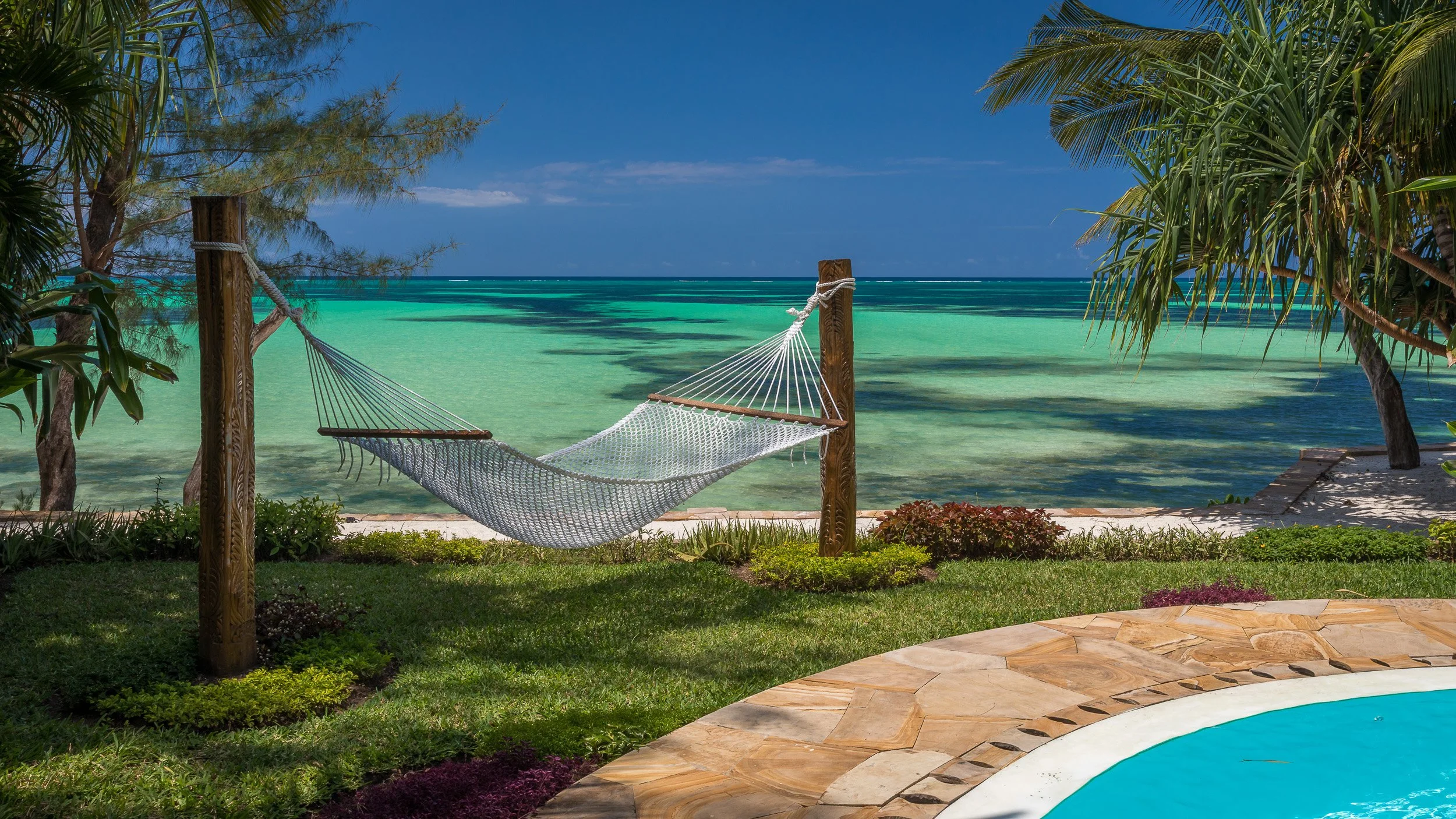
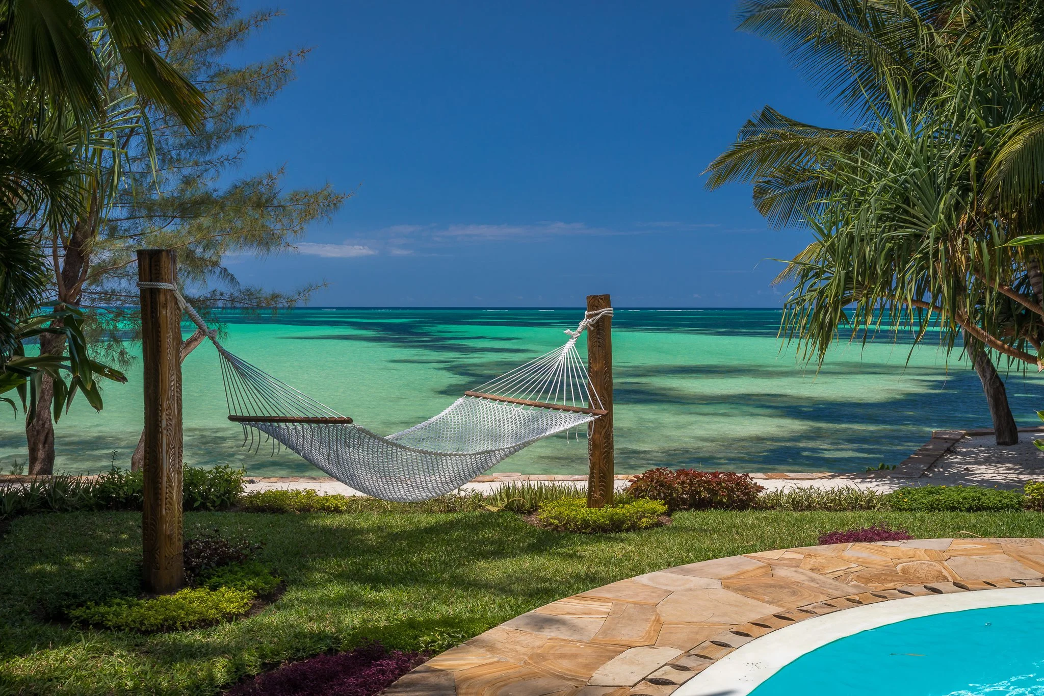
Tulia Resort in Zanzibar, Tanzania, with a hammock, palms, pool edge and clear Indian Ocean water in a quiet beachfront setting.
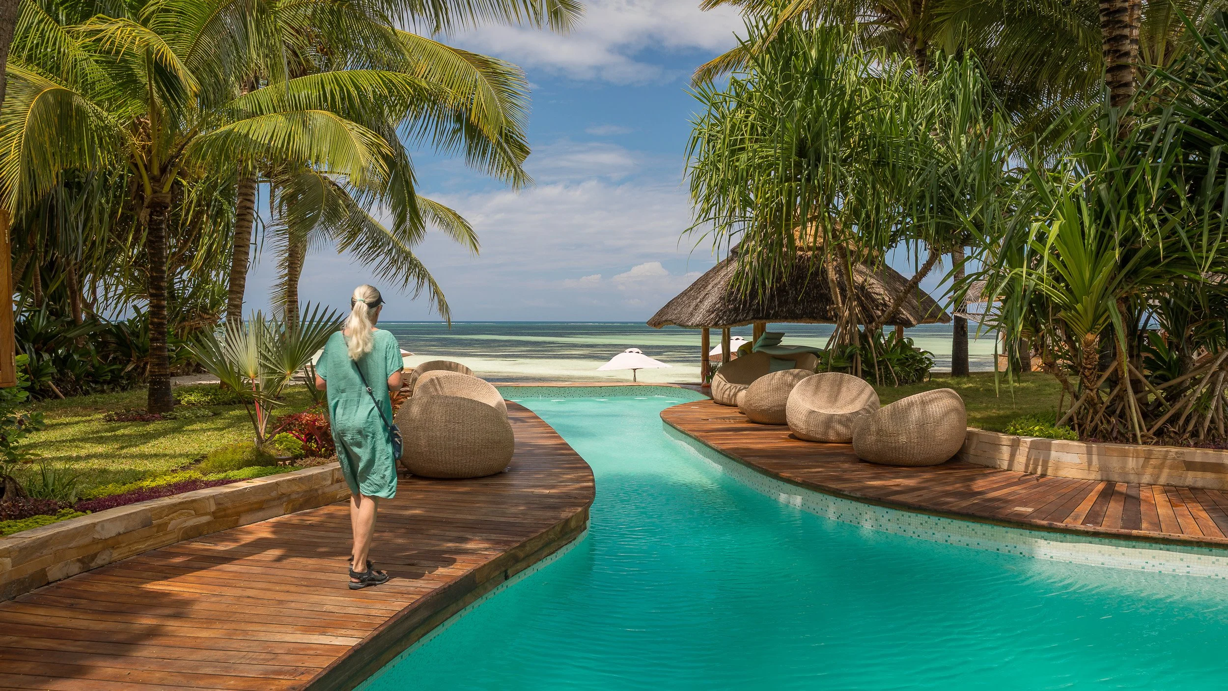
Tulia Resort in Zanzibar, Tanzania, with a woman walking beside a pool framed by palms, tropical planting and Indian Ocean views.
Travel stories from Journal
Some destinations are best explored not only through the gallery, but through the story behind the place, the light and the journey.
Zanzibar, Between Stone Town and the Indian Ocean
Photographing on Safari in Maasai Mara
Mauritius Beyond the Postcard
Iceland, from Waterfall Mist to Black Sand and Ice